
Yigo (Yigu)
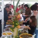
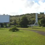
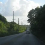
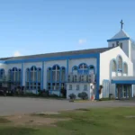
Table of Contents
Share This
Origin of village name in CHamoru
The meaning of “Yigo” is unclear. According to some, it comes from the Spanish word yugo which means yoke (the type used to secure a carabao to a cart or plow). However, some sources refer to the area as Asyigo which means the home of (a person known as) Yigo. If this is the case, “yigo” may be an ancient word thats meaning has been lost.
Population
The approximate population of Yigo, as of the 2010 US Census was 20,539.
Village officials
The mayor of Yigo is Frances S. Lizama. The vice mayor is Pedro Suzuki Blas.
Village description
Yigo is the island’s largest and most northern village, encompassing 35 square miles. On the map, the village looks like a triangle that stretches from Pati Point to Ritidian in the North, and from Ritidian to the coast near Pagat.
Yigo is the home to Andersen Air Force Base which has restricted access to the beaches of the village. Yigo has numerous housing subdivisions that have sprung up in the last three decades, but it still retains a rural feel thanks to its large open spaces and dense forests supported by some of the richest soil on Guam. Like all northern Guam villages, it sits on top of the Northern Aquifer, which supplies about 80 percent of the island’s drinking water supply.
Village history
During ancient times, Guam’s northern coast was home to a large number of villages. Evidence of latte dwellings also point to a significant population living in the Mt. Santa Rosa and Mataguac areas. During the Spanish CHamoru/Chamorro Wars in the late 17th century, major areas of settlement included Hanom, Tarague, Hinapsan, and Upi. Hanom, a freshwater spring on the coast south of Mt. Santa Rosa, played an important role as a refuge for the CHamoru resistance during the Spanish-Chamorro Wars. In August 1679 Spanish forces, along with their allies from Nisihan, defeated the Hanom CHamorus. The battle was described as “one of the fiercest which had taken place in the Marianas.”
By the early 18th century, Guam’s population had been greatly reduced by war and disease. All remaining CHamorus from northern Guam were relocated to six church-centered villages in central and southern Guam (Hagåtña, Hågat, Humåtak, Malesso’, Inalåhan and Pago). However, the area remained open to hunters and fishermen.
During the 19th century, wealthy residents of Hagåtña began to acquire large areas of land in this fertile part of the island. The rich soil proved excellent for cocoa which was used to make hot chocolate, a popular afternoon drink for Hagåtña residents. The area was also known for other agricultural products including coffee, avocado, citrus, and copra. The area of Upi, now Northwest Field, was particularly important for its cattle ranches while several wealthy landowners established copra plantations along the northern coast and in the area of Yigo proper.
By the early years of the American administration, some CHamorus chose to settle permanently in Yigo and surrounding areas. In 1912, the first school opened for grades one through four. In 1919, the US Government authorized land use permits for up to 25 years to attract more farmers to the area. In 1920, Our Lady of Lourdes Chapel was erected so that the people of Yigo would no longer have to make the long journey to Hagåtña each week for mass.
The new village of Yigo was highly self-sufficient because of its excellent farm lands. However, people still had to travel to Hagåtña to buy household goods. In 1925, Jose M. Torres solved this problem by building the first village store. Torres was a copra trader and would accept coconuts in exchange for groceries. By 1940, Yigo and surrounding areas were home to about 40 families spread out over large distances.
During World War II, most Yigo families were able to stay in the area. Some Hagåtña families relocated to their ranches in the Yigo area, to stay out of the way of the Japanese. However, towards the end of the war, Yigo became the site of a major battle as American forces pursued the Japanese up the center of the island. The final major battle occurred at Yigo on 7 and 8 August 1944, destroying the church and many village homes.
The end of the war brought many changes to Yigo. The village population soared during the post-war years, as displaced Hagåtña families settled ranch lands in the area. Additionally, some of the many non-CHamorus who came to Guam as part of the Civil Service and military decided to make Yigo their permanent home. While some villagers continued to farm, the village began to reorient its economy to the presence of Andersen Air Force Base. Since the 1980s, Yigo has continued to grow, mostly through the construction of public and private housing subdivisions.
Yigo is now the island’s second most populated village.
Points of interest
Village map
Institutions
Our Lady of Lourdes Church
This church was founded in 1920 and continues to serve the village’s Catholic community. Yigo’s fiesta is held the second Saturday of February in celebration of Our Lady of Lourdes.
Guam Public Schools
There are five public schools located in the northernmost village, including Simon A. Sanchez High School, FB Leon Guerrero Middle School and Daniel L. Perez, Upi and Machanaonao elementary schools.
Private Schools
There are also private schools including Trinity Christian School and Dominican Catholic School, which is part of the Archdiocese of Agana Catholic School System.
Department of Defense Schools
Located within the gates of Andersen Air Force Base are the Andersen Elementary and Middle School. They are part of the US Department of Defense (DoD) Domestic Dependent Elementary and Secondary Schools (DDESS) on island for children and wards of active-duty military members, and federal employees hired from the US with “return rights”. The DoD DDESS schools on Guam opened 29 September 1997.
Historical
Battle of Yigo Monument
This monument commemorates the final battle of World War II on Guam. As Americans worked their way up the center of the island in early August, 1944, the Japanese fortified their positions around Mt. Santa Rosa. On August 5 the US Army’s 77th Infantry were bombarded with artillery. They finally made it through the Japanese roadblocks and secured the summit of Mt. Santa Rosa on August 8. The memorial is just off Route 15 (Back road to Andersen) and Chalan Lolan, not far from the back gate.
Pacific Peace Memorial Park
This memorial was erected by a Japanese group to commemorate all those who died on Guam during World War II. It is located just off Marine Corps Drive at Mataguac, the site of the last Japanese command post. Although the island was basically secure, General Obata, Commander of the Japanese forces was still holed up in his command post. It was stormed by American troops on August 12, 1944. Rather than surrender, General Obata committed suicide in his bunker.
Recreational
Mt. Santa Rosa
This is the highest point in northern Guam. From lookout areas near the summit, one can see excellent views of Guam and Rota. At one point there was a pineapple farm in this area.
Yigo Race Track
Built in 2001, just off of Route 15, this drag strip and off road track is a popular local attraction.
Village mayors/commissioners
- Frances S. Lizama, Mayor, 2025-Present
- Anthony P. Sanchez, Mayor, 2021-2024
- Rudy M. Matanane, Mayor, 2013-2020
- Robert S. Lizama, Mayor, 1997-2012
- Eduardo C. Artero, Mayor, 1993-1997
- John F. Blas, Commissioner/Mayor, 1989-1993
- Jesus P. Cruz, Acting Commissioner, 9/1988-12/1988
- David G. Blas, Commissioner, 1981-9/1988
- Antonio A. Calvo, Commissioner, 1968-1981
- Juan G. Blas, Commissioner, 1965-1968
- Jose D. Perez, Commissioner, 1957-1965
- Juan M. Santos, Commissioner, 1954-1957
- Manuel A. Calvo, Commissioner, 1948-1954
- Jesus C. Artero, Commissioner, 1945-1948
- Juan A. San Nicolas, Commissioner, 1944-1945
- Manuel F. Taguacta, Commissioner, Pre-World War II
- Manuel F. Torres, Commissioner, Pre-World War II
Vice mayors/deputy commissioner
- Pedro Suzuki Blas, Vice Mayor, 2025-Present
- Loreto Leones, Vice Mayor, 2021-2024
- Anthony P. Sanchez, Vice Mayor, 2014-2020
- Ronald “Ron” J. Flores, Vice Mayor, 2009-2013
- Jose P. Leon Guerrero, Deputy Commissioner (under Machananao), Pre-World War II
Editor’s note: The preceding list was provided by Konsehelon Mahot Guåhan/the Mayor’s Council of Guam.
For further reading
Beaty, Janice J. “What’s in a Guam Name?” Pacific Profile 4, no. 2 (February 1966): 6-9.
–––. Discovering Guam: A Guide to its Towns, Trails and Tenants. Tokyo: Tokyo News Service, 1967.
Guam Department of Parks and Recreation Division of Historic Resources. A Study of Eight Post-World War II Resettlement Villages on Guam. By Rosalind Hunter-Anderson and Darlene Moore. Mangilao: MARS, 2006.
In Commemoration of the Blessing of Our Lady of Lourdes Church, May 5, 1965. Yigo: Our Lady of Lourdes Church, 1965.
Lévesque, Rodrigue. History of Micronesia: A Collection of Source Documents. Vol. 5, Focus on the Mariana Mission. Québec: Lévesque Publications, 1995.
Mary, Mother of Our Faith: 25th Anniversary of Our Lady of Lourdes Church, May 5, 1965-1995. Yigo: Our Lady of Lourdes Church, 1995.
Mayors Council of Guam. “MCOG – Mayors Council of Guam.”
Onedera, Peter R., ed. Nå’an Lugåt Siha gi ya Guåhan (Guam Place Names). Hagåtña: Chamorro Language Commission, 1988.
Rogers, Robert. Destiny’s Landfall: A History of Guam. Honolulu: University of Hawai’i Press, 1995.
Salas, Joe, PLG Guerrero, and J. Bitanga. A Glossary of Guamanian Place Names Located by Land Square, Section and Unit. Held by the MARC. Army Map Services, 1947.
Sanchez, Pedro C. Guahan Guam: The History of Our Island. Hagåtña: Sanchez Publishing House, 1987.
Know my island - Know my history
Guam’s first American Governor Richard Leary noted that prominent landowners in the areas surrounding Yigo in 1900 included the first Chamorro Catholic priest Padre Jose Torres Palomo, Dona Rufina Quitigua, Don Gregorio de la Cruz Perez and Joaquin Kamminga. The Artero family also acquired a large amount of land in the Upi area in the late nineteenth century.
The founding families of Yigo village in the early twentieth century include the Calvos (Familian Ne), Perez (Familian Goyu), Iglesias (Familian Checha), Taguacta, Cruz (Familian Anaco), Blas (Familian Tugung), Pangelinan (Familian Diego), Torres (Familian Cortes), Taitano and Sablan.
Some of the regions now encompassed by the municipality of Yigo include Upi, As Ardas, I Milalag, As Donlucas, Lupog, Mataguac, Ritidian, Sabanan Palie, Ipiga, Chaguian, As Tobias, Anao, Tarague, Jinapsan, Tailalo, Finaguayac, Alacunao, Caiguat, Hanum, Gayinero. Before the WWII Alacunao, Tailalo, Jinapsan, Ritidian, As Tobias, Caiguat and Finaguayac fell within the boundaries of the Municipality of Machanao, which no longer exists.