
POP Cultures: Federated States of Micronesia
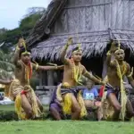
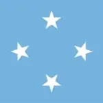
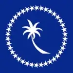
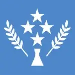

Table of Contents
Share This
Map
Flags

Flag of the Federated States of Micronesia

Flag of Chuuk

Flag of Kosrae

Flag of Pohnpei

Flag of Yap
Quick facts
Official Name: Federated States of Micronesia
Indigenous Peoples: Chuukese, Kosraean, Pohnpeian and Yapese
Official Languages: Chuukese, Kosraean, Pohnpeian and Yapese
Political Status: Independent, Freely Associated with the United States
Capital: Palikir, Pohnpei
Population: 103,549 (2013 est)
Greeting:
History and geography

Together, the four states of the Federated States of Micronesia (FSM) are made up of around 607 islands (a combined land area of approximately 702 sq km or 271 sq mi) that cover a longitudinal distance of almost 2,700 km (1,678 mi) just north of the equator. They lie northeast of New Guinea, south of Guam and the Marianas, west of Nauru and the Marshall Islands, east of Palau and the Philippines, about 2,900 km (1,802 mi) north of eastern Australia and some 4,000 km (2,485 mi) southwest of the main islands of Hawai’i.
While the FSM’s total land area is quite small, it occupies more than 2,600,000 sq km (1,000,000 sq mi) of the Pacific Ocean. The capital is Palikir, located in Pohnpei Island, while the largest town is Weno, located in Chuuk.
Each of its four states is centered on one or more main high islands, and all but Kosrae include numerous outlying atolls. People from Island Southeast Asia first settled in Chuuk, Kosrae, Pohnpei and Yap some 3,000 years ago. Each of the islands has its own language, some with several dialects. The people interacted with each other as well as with the CHamorus of the Marianas throughout their history.
In 1525 Portuguese sailors came upon Yap and Ulithi. Spanish expeditions later made the first European contact with the rest of the Caroline Islands. Spain claimed sovereignty over the Caroline Islands until 1899. At that time, Spain withdrew from its Pacific insular areas and sold its interests to Germany, except for Guam which became a territory of the United States. German administration encouraged the development of trade and production of copra. In 1914, the German administration ended when the Japanese navy took military possession of the Marshall, Caroline and Northern Mariana Islands.
Japan began administering the islands under a League of Nations mandate in 1920. Extensive settlement in the region resulted in a Japanese population of more than 100,000. The indigenous population was then about 40,000. Sugar cane, mining, fishing and tropical agriculture became the major industries. As World War II began, Japan’s focus turned to war and prosperity in the region ended. By the war’s conclusion in 1945 most infrastructure had been destroyed by US bombing.
After the war, the newly formed United Nations created the Trust Territory of the Pacific Islands (TTPI) in 1947. Ponape (then to include Kusaie), Truk, Yap, Palau, the Marshall Islands and the Northern Mariana Islands, together constituted the TTPI administered by the US.
In July 1978, following a Constitutional Convention, the people of four of the former Districts of the Trust Territory, Truk (now Chuuk), Yap, Ponape (now Pohnpei) and Kusaie (now Kosrae) voted in a referendum to form a Federation under the Constitution of the Federated States of Micronesia (FSM). Upon implementation of the FSM Constitution on 10 May 1979, the former districts became states of the federation, and in due course adopted their own state constitutions. The Compact of Free Association (COFA) with the US was signed in October 1982, and went into effect in November 1986. The Compact was renewed in 2004, and allows for FSM nationals to live, work and travel freely in the US and its territories, while allowing the US to maintain its military strategic interests in the area. The US also provides postal services.
The FSM’s economic activity consists of subsistence agriculture, fishing and tourism. Financial assistance from the US is the primary source of revenue. Geographical isolation and a poorly developed infrastructure are major impediments to long-term growth. Foreign commercial fishing fleets pay for the right to operate in FSM territorial waters.
Visitors come to the FSM for scuba diving and to see the ancient ruins of Nan Madol on Pohnpei, stone money and manta rays in Yap and to see the sunken World War II fleet in Chuuk.
Arts and culture
.jpg "Pacific Partnership 2024-2 Yap - Guampedia - Guampedia")
Traditional arts such as dance, weaving, singing and carving can all be found in each of the FSM. Each state has its own distinctive culture and arts. Pohnpei is well known for its embroidered skirts and ivory nut carvings, Kosrae for its singing, Yap for its colorful costumes and traditional dancing and Chuuk for its carved masks and war dances.