Malesso’/Merizo


Origin of village name in CHamoru
Always known as a place for fishing, the village’s original name, Malesso’, derives from the CHamoru word lesso’, a juvenile stage in the growth of rabbit fish. Juvenile rabbit fish, or mañåhak in CHamoru, run in schools at certain times of the year in the bays and inlets of the village. Their arrival is always an occasion of great excitement, as groups of people large and small work nets to gather the local delicacy.
Population
As of the 2010 US Census, the population of Malesso’ was 1,850.
Village officials
Ernest T. Chargualaf is the mayor of Malesso’.
Village description
Malesso’ skirts Guam’s scenic southern shoreline on a long strip of land between mountains and sea.
Cocos Lagoon, several miles square and enclosed by a large triangle of reef, extends about three miles out from the village. Cocos Island Resort draws day visitors to the small, densely vegetated, low-lying strip of land along the lagoon’s southern exposure. The lagoon is distinguished from the deeper water outside the reef by an array of vivid blues and greens that signify shallow water over sand flats and protected coral gardens. Mama’on Channel, the lagoon’s deep main pass, runs west to east past M Pier and the village boat ramp, gradually shallowing as it cuts farther into the lagoon.
Fiestan Tasi (Festival of the Sea) is held annually in Malesso’, and celebrates the importance of the ocean to Guam’s past, present, and future. It often includes boat races and other water sports competitions and exhibitions. Dates of the festival vary from year to year.
On the other side of the winding main coastal road, Route 4, several rivers flowing to the sea from the nearby mountains cut lush valleys through dry savanna foothills. Much of the population lives in these rural valleys, which are mainly residential areas dotted with a few farms and ranches, shadows of the community’s agrarian past.
So far, residents have viewed cautiously any prospect of extensive development, and the village remains primarily residential. Commerce is limited to the privately owned Cocos Island Resort and its ancillary vendors, and to a few small village-based retail stores, a gas station, and a branch of the Bank of Guam.
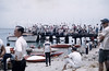
In May, swimmers travel from all over Asia to join local swimmers in the Cocos Crossing, a 2.5-mile race from Cocos Island, on the southern edge of Cocos Lagoon, across the lagoon to Malesso’ Pier.
Village history
While there are few accounts of the pre-Spanish colonial era on Guam, Malesso’s abundance of fresh water, its protected lagoon, extensive reef, and shorelines, and its fertile valleys suggest that the area likely sustained a large population. By 1833, however, the population was estimated at only 318. By this time, disease, calamity, and the Spanish-CHamoru wars had reduced the native CHamorus.
Despite the dramatic decrease in the CHamoru population during the Reduccíon (efforts to subdue CHamorus into accepting Christianity and Spanish rule), the population of Malesso’ was significant enough for Father Diego Luis de San Vitores to order the building of the fifth mission on Guam in Malesso’ in 1672. No trace of the original mission structures exists today. The recently restored Malesso’ Kombento, home to the parish priest, and the Kampanayun Malesso’ (Malesso’ Belltower), both Spanish-era structures, as well as the new church dedicated in September 2002, attest to the church’s enduring place in village life.
In March 1721 a drunken British privateer captain, angered over soured hostage negotiations, brashly tried to steal a Spanish supply ship anchored in front of the village in the Mama’on Channel. The British ship ran aground. The beleaguered crew, fired upon from shore cannons at close range, finally wrested the vessel off the reef and escaped after a 50-hour battle that killed two of them.
Life in Malesso’ went on more or less quietly through the turn of 20th century, even as American naval rule replaced the Spanish on Guam. That would change in the dawn of World War II. During the Japanese invasion of Guam in 1941, a contingent of 5,000 Japanese invasion troops came ashore at Bile Bay on Malesso’s western shore. Finding no road to Hågat, the soldiers re-boarded their boats and headed north to join their comrades.
The Japanese occupation of Guam set Malesso’ on a course that, in July 1944, would make the village a focus of infamous brutality and stirring heroism. Almost four years after the Japanese invasion and occupation of Guam, their situation began to grow desperate as American ships bombarded the island in preparation for the July 21 landing and retaking of Guam. The Japanese troops stationed in Malesso’ rounded up two groups of 30 CHamorus each. Forty-six CHamorus were slaughtered with grenades, bayonets, and sabers.
At Tinta, in the Geus River valley, some escaped death by lying still under the corpses of their relatives and friends, while others were able to flee. Not one of the 30 in the second group survived the massacre at Faha, just behind the village cemetery. Each year in July, people hike for prayer services to the original massacre sites in remembrance of the 46 villagers. Similar massacres took place in Fena, near the present day Sånta Rita-Sumai, and Yigo.
When word of the massacres got to villagers, who by that time had been marched inland to a camp, seven Malesso’ men killed 10 Japanese soldiers and drove the rest from village. This left Malesso’ the first village on Guam to be liberated, and the only one to be liberated by the CHamorus themselves.
At this point, a group of six Malesso’ men paddled and sailed a canoe out to a US warship. The crew picked up the CHamoru men, and the six served as scouts in the effort to retake Guam.
Points of interest
Village map
Institutions
Malesso’ Martyrs Memorial School
Constructed in 1966, this is one of the public elementary schools on Guam. The school sits between the Malesso’ Community Center and the Office of the Mayor of Malesso’ atop Pigua, a high spur of land that forms one side of the Geus River Valley.
San Dimas Catholic Church
A new church building was dedicated 29 September 2002, replacing a dilapidated wood-and-tin structure that had served parishioners as a church for more than a decade. Mass and festivities honoring Malesso’s patron, San Dimas, occur annually on the third weekend of April.
Historical
Kampanayun Malesso
The Malesso’ Belltower, or Kampanayun Malesso just across the main road from the Kombento, dates to 1910 and the tenure of Father Cristobal de Canals. It was included in the National Register of Historic Places and restoration efforts took place in the early 1980s.
Malesso Kombento
This 19th century building was restored in 2000 to its original design under a grant from the Guam Preservation Trust. It is the home of the parish priest and office.
Merlyn G. Cook School
Now a youth recreation center near the Malesso’ Pier park, the building originally housed a naval radio facility in the early 1920s. Named in 1931 for the Guam Public School System’s first leader, it served as the village schoolhouse for a decade in the late 1920s and early 1930s. The Guam Preservation Trust restored the building in 1997 and is maintained by the mayor’s office so it could be used again by village residents.
Santa Marian Kamalen shrine/park
Across the street from the kombento, a small park holds a marble statue of Santa Marian Kamalen. There is a plaque explaining that according to local legend, the site is where a fisherman from Malesso’ was fishing in the bay, between Malesso’ and Cocos Island, when he spotted a statue of the Virgin Mary being carried by two golden crabs.
Recreational
Cocos Island
The narrow, mile-long island, originally called Dano, lies about two miles off the village along Guam’s southern reef line, with the Pacific Ocean on one side and Cocos Lagoon on the other. About a third of the island at the west end is a government-owned public park, and once was the site of a U.S. Coast Guard LORAN station. Camping is permitted. The other two-thirds is a privately owned day resort. The Rothschild family, of banking fame, once owned the whole island. They were copra traders in pre-war Guam.
The small island now also serves as a refuge for ko’ko (the Guam rail).
Malesso’ Fiestan Tasi
Malesso’ Fiestan Tasi, or Malesso’ Festival of the Sea, is an annual event held in November that celebrates the importance of the ocean in CHamoru culture. Thousands of people gather in Malesso’ to enjoy the various water races, a fishing derby, an ocean parade filled with decorative floats, CHamoru cultural displays, arts and crafts, concession stands, and southern hospitality.
Malesso’ Pier and Small Boat Ramp
This public facility fronts Mama’on Channel, the main pass into Cocos Lagoon.
Priest’s Pools
The Priest’s Pools are natural freshwater pools in the Pigua River hidden in the hills of Malesso’.
Village mayors/commissioners
Mayors/Commissioners
- Ernest T. Chargualaf, Mayor 2009 – Present
- Sherry L. Chargualaf, Mayor, 2007-2008
- Sherry L. Chargualaf, Acting Mayor, September 2006 – December 200
- Rita A. Tainatongo, Mayor, 2001-2006
- Ignacio “Buck” S. Cruz, Commissioner/Mayor, 1986-2000
- Jose R. Tyquiengco, Commissioner, 1981-1985
- Ignacio “Buck” S. Cruz, Commissioner, 1979-1980
- Joaquin Q. Acfalle, Commissioner, 1977-1979
- Francisco C. Chargualaf, Commissioner, 1957-1976
- Ignacio M. Reyes, Commissioner, 1953-1956
- Jesus C. Barcinas, Commissioner, 1944-1952
- Juan E. Lujan, Commissioner, 1931-1941
- Ramon P. Cruz, Commissioner, 1922-1930
- Prudencio Gogue, Commissioner, 1917-1921
- Jose Ada Reyes, Commissioner, 1915-1916
- Jose Lujan, Commissioner, 1910-1914
Deputy Commissioner
- Jesus C. Barcinas, Deputy Commissioner, (no dates provided)
| Editor’s note: | The preceding list was provided by Konsehelon Mahot Guåhan/the Mayor’s Council of Guam. |
|---|
For further reading
Guam Department of Parks and Recreation. “Guam State Historic Preservation Office.”
Guam’s Parks and Historic Places. An Interpretive Companion. Hagåtña: GDPR, 1993.
Haynes, Douglas E., and William L. Wuerch. Historical Survey of the Spanish Mission Sites on Guam 1669-1800. MARC Education Series no. 9. Mangilao: Richard F. Taitano Micronesian Area Research Center, University of Guam, 1990.
Mayors Council of Guam. “MCOG – Mayors Council of Guam.”
Onedera, Peter R., ed. Nå’an Lugåt Siha gi ya Guåhan (Guam Place Names). Hagåtña: Chamorro Language Commission, 1988.
Palomo, Tony. An Island in Agony. Self-published, 1984.
Rogers, Robert. Destiny’s Landfall: A History of Guam. Honolulu: University of Hawai`i Press, 1995.
Villalobos, Francisco Ramon. Geographic, Military, and Political Description of the Island of Guam. MARC Working Paper 8. Translated by Felicia Plaza, MMB. Mangilao: Richard F. Taitano Micronesian Area Research Center, University of Guam, 1979.
Know my island- Know my history
In 1946, the first woman was elected to the Guam Congress. Rosa Aguigui Reyes, from Malesso’, served in the congress – an advisory body to the island’s naval governor – and was also a longtime educator. She died January 2007 at the age of ninety-one.